Illustrated bespoke location maps, hand drawn to show places of interest
Whether as a location map of your premises, or a illustrated map showing features of a local area, hand drawing is the best solution.
An accurate location map showing key features can only be done by drawing, either on paper or on computer. With a bespoke map you can highligh key features and landmarks. Whatever style you favour; from a very techincal diagramic map, to stylised, or cartoon styled map.
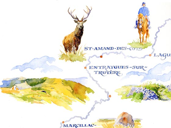
I've also provided many maps for illustrating tourist articles for countryside magazines. Not really for accuracy, or communicating a location, more as a picture of the surrounding district and locations. Highly decorative with calligraphic lettering, making what would be a very bland map come alive!


Simplified clear office or site location map

An illustrated bespoke map to show your site location with key places and landmarks helps people to easily see where you are located.
An illustrated map with creative hand lettering

An illustrated map with hand lettering or caligraphy gives the map real interest and makes it a work of art... beat that google maps!
Hand drawn 3-D map gives you a view from above

An aerial view with simplified and exaggerated views of the key land marks and buildings enables the map to be easier to see where you are.